Friday, 20 December 2013

Winter Woodland Wanderings

Living in the south of England for the winter, adventure potential has decreased somewhat, so I was excited to take up Al Humphries' Winter Solstice Microadventure challenge.  The idea is basically to get outside, sleep without a tent and remember why nature's fun.
I decided to take my hammock into the woods just outside Henley, have a fire and listen to the sounds of the woods.  The woodland was damp and musty when I arrived, making fire lighting quite tricky.  I used a  fungi from a dead tree with a flint and steel to get an ember, then dry beech leaves to get some flames going.

Whisky and fire warmed my body as I listened to muntjac deer barking, ows hooting and squirrels rustling for company. 
I had forgotten how cold it gets at night, especially with a frost but eventually I got some sleep and awoke to the sound of animals going about their morning chores and the sun twinkling through the trees.
I packed up quickly, strode across the frosty golf course, staggered up the hill, arriving back home for a huge cup of tea and some boiled eggs.

"Think big, start small but do start" - Al Humphries

Saturday, 23 November 2013

Snapping with Shutter Scotland

David Russel was running a free taster photography course as part of his new company ‘Shutter Scottland’. We arrived at our morning venue, Loch an Eilean, with no wind and a stunning view.  The fantastic castle, Scotts pine and silky Loch made for an excellent venue choice even with the low light levels.
First shot of the day, a moody Loch an Eilien.
Playing with 'depth of field' with some funky looking lichen.
We started with a free for all 'point and shoot' session, designed to unleash our creative juices and get used to the cameras.
With the low light levels, big awesome landscapes were tricky.  David suggested focusing in on the small details.
We moved quickly to look at the ‘nuts and bolts’ of the camera.  Exposure was the first topic of conversation, discussing how; ISO, shutter speed and aperture affected the amount of light reaching the sensor. We had a play in the 'AP' (aperture priority mode), adjusting the depth of field to emphasise features and draw your eye through the image.
I love the texture and color of Scotts Pines.
Next on the list was composition.  I had previously experimented a lot with the ‘rule of thirds’ so was happy to hear about using lines to draw the eye through an image and how layers create sense of depth and heightened interest to an image.
I like how the foreground layers bring your eye into the contrasting perpendicular trees.
Again playing with different layers to create a sense of depth.
After a well earned lunch, David showed us some of his great images to inspire us to work with different type of light in the afternoon.  Back lighting, raked light, direct light and diffuse light were all mentioned in the slideshow and it was a pity that the afternoon light didn't give us the chance to work with all of these different styles.
I loved these colors and shape, just like a woodland rainbow.
An awesome log in the 'Green Lochan'.  Lines lead into the shot.
We finished with a quick look at panoramas.  Lots of portrait shots stuck together, ensures a good height, high resolution and a huge width.  With a steady upper body and some cunning software, David explained that taking great panoramas was quite simple.
My first attempt.  Can't wait to do it on a high snowy mountain.
Take home messages
  • If you want to be a better photographer, stand in front if more interesting stuff.
  • Find something interesting, then 'dance around it' until you find a good angle.
  • Once you understand the technical stuff, the rest is down to artisticness.
Cheers David for a great day.  I learned a lot and am now inspired to play with all the light techniques once we get a nice sunny day.

Thursday, 21 November 2013

Use of Google earth for planning whitewater expeditions

I first realised how useful Google Earth could be for expeditions when I watched this great TED talk about using Google to plan a climbing expedition.   Tim Burn then used to it plan a kayaking trip to Sulawesi

Whilst planning a kayak expedition to Borneo, I was keen to use Google Earth and see how useful it could be.
Finding rivers with potential for Kayak Borneo before we headed out.
Accurate maps of many countries are incredibly hard to come by, especially ones with contours detailed enough to work out gradients.  This is where Google Earth came in really handy.  Its new cloud free satellite imagery of the whole world and topographical (height) data means you can gain a lot of information about rivers all over the world.

Drawing a ‘Path’ down your intended river enables you to see; the average gradient, particularly steep sections and distance.  Combined with the satellite imagery, you can see bridges, villages and roads for potential access and egress points.  With recent and detailed images, newly built dams and other potential hazards such as weirs and rivers going underground can also be seen.  It is also to see the size of individual rapids and even start to scout possible lines!
Scouting the Humla Karnali using Google Earth.
If looking at a lot of rivers, like we did for Kayak Borneo, it is really important to establish a key for them before things get too confusing.  Creating a document with all the important stats on the river before you head out means that before you even land in the country, you have a hit list of rivers to check out.

Another cool feature that is possible to make fly overs which can be used to make grant applications and also give perspective to videos after the trip.


How is it all possible

I think this is a good point to stress that I am a technophobe but with a little bit of time on Google and scrawling through help forums and youtube, it is easy to work things out.
First download Google Earth a ≥ medium power computer is needed to get then most from it
Find a river
After finding a country with loads of whitewater potential, start finding rivers to explore.  A paper map can be useful for this but not essential and it is easy to mistake roads for rivers.
Google Earth showing the Tutoh deep in the Heart Of Borneo
Adding a path
Use the 'add path' button on the tool bar.  Carefully draw a line down the intended river.  You can remove sections from each end by selecting the final point then 'right clicking'.  In the pop up box, rename the river (think carefully about a coding system) and also change its 'style and color'.
'add path' button - http://www.google.com/earth/outreach/tutorials/annotate.html
Path added in Google Earth.
Once a path is added, it is possible to get a lot of information from the satellite imagery.
Calculating gradients
The topography data contained in Google Earth is also really useful.  By right clicking on a river in the 'Places' menu and selecting 'Show Elevation Profile', a graph appears in the bottom of the image.  It is possible to quickly see river length and rough gradient variations.  The river appears to rise and fall rapidly along the length of the graph.  This is due to low resolution topography data and also not quite following the rivers course.  Not a problem.
To calculate an over all gradient, divide the height difference from get on to get off by the total length.  Keep it in meters over kilometers to get a useful number.  For low volume runs 25m/km to 50m/km is good.  for example the Nevis is 30m/km.  For higher volumes, a lower gradient is ideal.

Making a flyover
This is when it gets cool.  Select the river to make a flyover with and press the 'play tour' button.
'Play Tour' button on Google Earth
There is possibly an easier way to do this next step, however this is the way I found.  Download some 'screen capture' software then use it to film the 'Play Tour' in Google Earth.  You can adjust the screen size so it excludes all of the gubbins round the edges.  The output file can be converted from .xesc to .mp4 file for use in video editing.
Mid flyover in Google Earth
As with all technology, the future is exciting and mind boggling.  Google Street View kit is on rucksacks is traveling to some really remote areas such as the Grand Canyon making scouting rivers even more detailed.

I hope I have explained this process clearly.  If you are trying to follow this and you encounter problems, ether comment below or drop me a message or Google search.

Hurrah for Google!

Winter Wandering

In between Kieth and Jen's amazing wedding and the Glenmore Lodge IDS interview, I had some action packed days in a very wintry looking Scotland.
Stunning views from Mam na Gualinn, situated to the north  of Loch Leven.
First stop was Glen Coe staying with Ted Piper.  We had a great day following one of the lovely routes in the Cicerone Ben Nevis and Glen Coe walking guidebook.  Escaping Munroe status, Mam na Gualinn and Beinn na Caillich are squeezed in between the Mamores and Loch Leven.  They therefore boast incredible views onto the Aonach Eagach ridge, across the Mamores with the Ben's head poking into the clouds.
Ted Piper looking out across Stob Corie na h-Eighe in the Mamores
The weather chased us along the ridge, with incredible rays of sun, snow showers and a bitter breeze encouraging a brisk pace.
Spot the climbers!  Stob Corie an Lochan, South Glen Coe.
Patrick Jenner then joined in the fun with a trip up into the depths of Glen Coe.  On the way up to Stob Corie nan Lochan, we spotted some early bird climbers of the magnificent buttress overlooking the glen.  They certainly enjoyed their belay spot as we ventured up, into continually deepening snow.
Patrick Jenner striding out over Bidiean nam Bian
The views from the summit were stunning.  Scotland, in the winter, takes on a whole new level of awesomeness and to be the only ones up there was incredible.

With rain over night and a strong wind on the hills, it was time to hide in the gorges of Scotland.  The Nevis was first our first port of call.  Ted Piper, Callum Anderson and Scott Robinson were all game and even with a lowish level, a lot of fun was had.  A quick bash down the Spean gorge finished a great few days on the west coast.

Cheers Ted for putting me up and Paddy, Callum and Scott for some awesome days out.

Friday, 8 November 2013

Steep Learning Curve

Since Kayak Borneo, I have been traveling round the UK giving talks about our incredible trip.  I have spoken at paddle shows, canoe clubs, expedition companies and university societies.  
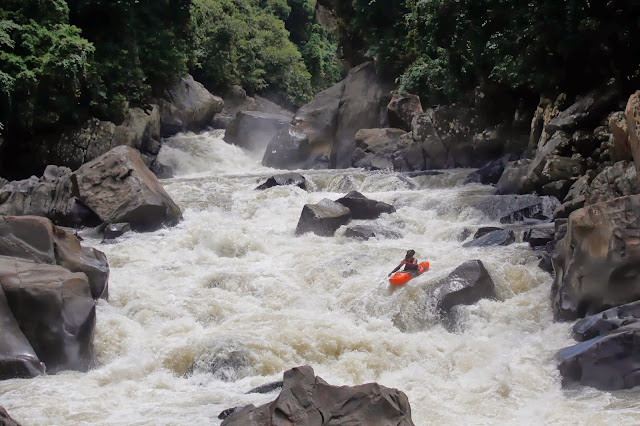
Sungai Telokosan - Kayak Borneo
It has been an incredible experience, meeting such a range of interesting people and learning all about how to present our trip to large audiences.

The learning curve has been very steep for me so I though I'd share some top tips.
Photo credit - Taura Edgar, RGS HK
Email everyone - There are so many people that would be keen to hear your story, unis, schools, societies, events and even companies, so sell you self and your trip to all of them.  Many wont respond however many who do respond are grateful that you thought of them.

Tailor it to your audience - Speaking to such a range of audiences is challenging but keeps things fresh.  Work out what your audience has come to hear and give it to them.  Entertain, educate, inspire them and afterwards get feedback from them.  What was  interesting, confusing or boring and then change it for the next time.

Slow down - My major problem is that I get too excited and speak quickly.  There is so much to think about when your up in front of a crowd.  Relaxing and slowing down removes the 'ums' and 'ars' and allows you to speak a lot more fluently

Break it up - Video is a great visual addition to any talk.  Short videos between talking gives variety for the audience but also a break for you.  Use this time to relax, plan the next bit of talking and soak up experience. 

Get testimonials - All organisers will be happy to give you short promotional quotes.  Gather these and use them when arranging future talks.  Let the quotes sell you, rather than your patter.

Mega bucks - Don't expect to be able to charge thousands of pounds or eve hundreds straight away. Offer to do talks that cover expenses or even for free, get experience, then, when your "product" is refined, slowly build up the price.

Learn from the masters - Alistair Humphries is a huge inspiration to me and his blogs are a constant source of inspiration.  Keep an eye on the pros and learn from them

And finally - Don't forget its meant to be fun.  It is difficult standing up in front of a big crowd but the key is to relax.  if you enjoy speaking, you audience will enjoy listening.

Happy adventures :)

Monday, 4 November 2013

Blissful Bothy Bash

The joys of unemployment allowed Patrick and I to live in a tent and car for a couple of weeks.  As a break from our soaking wet shelter, we decided to hit the hills and relax in some of Scotand's finest bothies.
 We parked up in Glen Tilt them motored up to the Allt Scheicheachan bothy to sleep.  An early start allowed us to beat the rain to the top of Beinn Dearg before descending into Glen Tarf.
This meant we arrived at the next bothy, the Tarf Hotel, by lunch.  We enjoyed many games of OS map battleships topped off with a delightful candle lit dinner and a solid 15h sleep.
We awoke to rain the next day making it difficult to leave the newly renovated, cosy bothy.  With our heads buried in our hoods to fend off the battering hail, we trudged over the bog and up a delightful stream, onto the top of Carn a'Chlamain.  
As soon as we started to descend, the rain stopped and views along the incredibly straight Glen Tilt captured our attention.  We stormed down the glen, taking stops to soak up the incredible autumn colors and bubbling burns filing the River Tilt.

Thanks Patrick for a great few days and the Mountain Bothy Association for the upkeep of these incredible shelters.

Friday, 1 November 2013

Autumnal Adventures

For a kayaker, autumn in Scotland is the time of plenty.  Rain is still wet, rivers still flow and hands don't freeze.  Hitching with a boat, however, poses great difficulty so this boat-less trip to Scotland required some ingenuity.
Patrick was keen to get some QMDs in, so with little persuasion, I joined him and headed to the hills.  We parked next to Loch Moraig near Glen Tilt and headed for a stunning horseshoe including; Carn Liath, Braigh Corie Chruihn-bhalgain and Carn nan Gabhar.  Occasionally the cloud lifted, revealing some moody scenery.  The trudge back to the car was enhanced by rays of sun bursting through illuminating the stunning colors all around.

We stayed at Sean's amazing house in the hills, complete with my favorite household item, a water heating, wood burning stove.  He was kind enough to lend some kit, so Paddy and I could enjoy the Tilt and Bran at great levels.  After documenting every piece of whitewater in Borneo, it felt great to paddle a river for the sake of paddling it.  Awesome.

The rain then cleared for a great day of climbing.  Dunkeld is an incredible place to climb anytime of the year, with sun pitching in and the stunning belay views down the Tay.  Autumn just made this spot even better.

Cheers for a great few days Patrick and thanks Sean for letting us invade. :) 

Tuesday, 1 October 2013

A Singapore Photo Bomb

During my nine hour stop over in Singapore I decided to make the most of it, armed with £4, I hit the town to see where my fortune would take me.

After blowing £2.35 on a return MRT ticket, I jostled with the crowds to get on the incredibly efficient Metro
First stop was the Mandarin Orchard Hotel.  Previously I have enjoyed a complementary/cheeky shower in the  prestigious Mandarin Oriental Hotel in Hong Kong so a step up was required.  I nosed around the stunning ball room,  strolled out on the tennis court before setting eyes on this island of paradise.  I stripped down to my pants in front of a  "buoyant" Korean man and enjoyed a thirty minute swim and shower.  The perfect way to relax between flights. 
After all of that exercise, it was time to get some food and blow some cash.  These tasty steamed red bean roles set me  back a whopping £1.10 and were worth every penny
I continued walking down the street, with no particular goal, until I saw an escalator, dragging people up and off the streets, up the side of this colossal building.  I ventured up five of these seemingly endless tracks, snaking up the Orchard Central Mall's exterior, eventually greeted by a fascinating sight of old and new Singapore. 
On the roof top of the Orchard Central Mall was this vibrant artwork by Yayoi Kusama,
entitled "Lets Go to a Paradise of Glorious Tulips".  I loved the incredible glossy
colors, especially with the back drop of the bustling city, giving a really positive, fun
and relaxing feeling.
Once totally covered in primary jungle, this 60 island city slowly encroaches on what green space is left. 
Modern architecture, part of the forth largest financial center in the world.
I was surprised to hear almost everyone on the train speaking English even after exactly 50 years of independence from
 the British.  The rush hour train back to the airport was certainly cosy.

Sunday, 29 September 2013

We Came, We Saw, We Conquered!

With low water in Sabah and only a few days before the leg two boys fly home, we decided some tourism was justifiable.

Our target, the huge mountain that we have been driving round and paddling off for the past two months. Mount Kinabalu, the highest mountain in Borneo, stands 4095m above sea level and dominates the surrounding UNESCO World Heritage site. The area hosts many incredible species including the endangered Orangutan making it “among the most important biological sites in the world".
The iconic summit of Mount Kinabalu rising out of the clouds.
Our tactic was a two day assault, including a night in a mountain hut and a summit sunrise. Nick and Jonny set off late on Thursday, confidently striding past fellow mountaineers reaching our luxurious mountain hut after three hours. We gorged ourselves on the enormous buffet, until we couldn't fit in any more mee goreng (fried noodles) or banana fritters in and staggered to bed ready for our summit bid.
A step up from Scottish bothies.
We woke at 0230h and partook in another overly indulgent buffet experience before hitting the trail at 0330h.
A bleary eyed 0330h start after a gigantic pre-summit buffet feast.
We donned headlights with Marcello and started off into the dark. Soon enough, we reached the line of other summiteers and added our head torches to the chain, snaking its way up 825m to the summit. We passed the tree line and began eating up the kilometers over the incredible smooth granite bedrock covering the mountain.
Tricky night nav. on Mount Kinabalu
The summit came into view as the wind battered our unprepared, equatorial accustomed bodies. We donned the bedding that we had ‘liberated’ from the mountain hut and felt very inadequate next to the hundred or so others kitted out in duvet jackets which wouldn’t have looked out of place in the arctic.
Kit aside, we had made it, and witnessed a stunning sunrise from the summit. Cloud filled the valleys below as we soaked up the incredibly barren summit finding time for a couple of obligatory summit poses.
The "Over-Under" defined as the "Pinnacle of summit poses".  Note bed linnin.
The Tea Set
Amazing sunrise looking across the vast granite plateau.
It was great to have climbed Mount Kinabalu and in doing so met lots of other travelers from around the world. Hearing all of their stories was great and makes our trip feel even more special. We are experiencing so much more of Borneo than the typical tourist, solely because we like sitting in big plastic pointy things :).
Mission accomplished with a little help from our trusty guide, Marcelo.